Advanced Surveying for the Nurek Dam Rehabilitation project : Laser Scanning and Photogrammetry
Gruner leads Cutting-Edge Assessment of Tajikistan's Iconic Hydroelectric Power Station
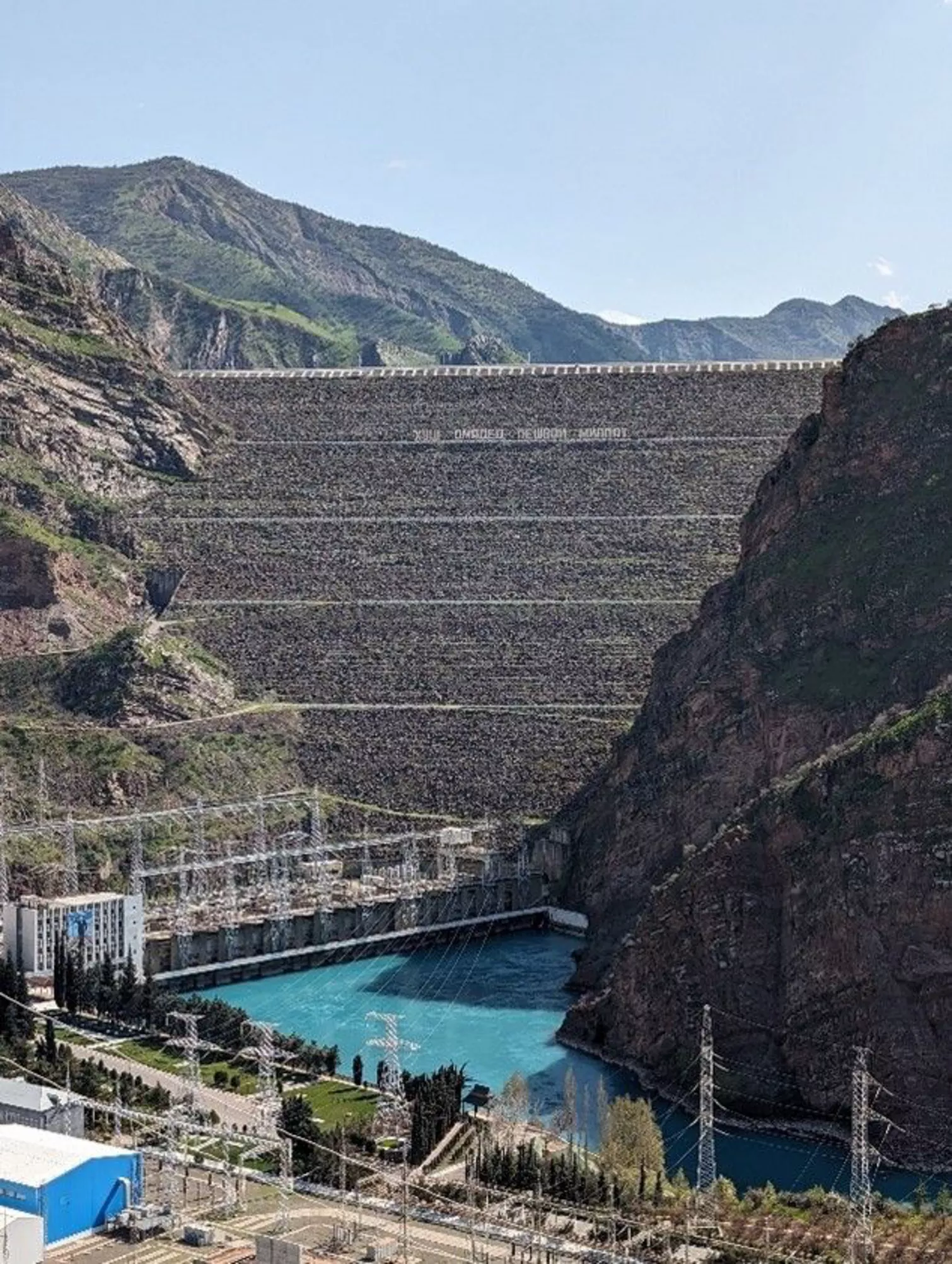
The Nurek Dam is an embankment dam on the Vakhsh River in Tajikistan. Its primary purpose is hydroelectric power generation, and its power station has an installed capacity of 3,015 MW. Construction of the dam began in 1961 and the power station's first generator was commissioned in 1972. The last generator was commissioned in 1979 and the entire project was completed in 1980 when Tajikistan was still a republic within the Soviet Union, becoming the tallest dam in the world at the time. At 304 m (997 ft) it is currently the second tallest man-made dam in the world, after being surpassed by the Jinping-I Dam in 2013. The Rogun Dam, also on the Vakhsh river in Tajikistan, will exceed it in size at 335m when completed.
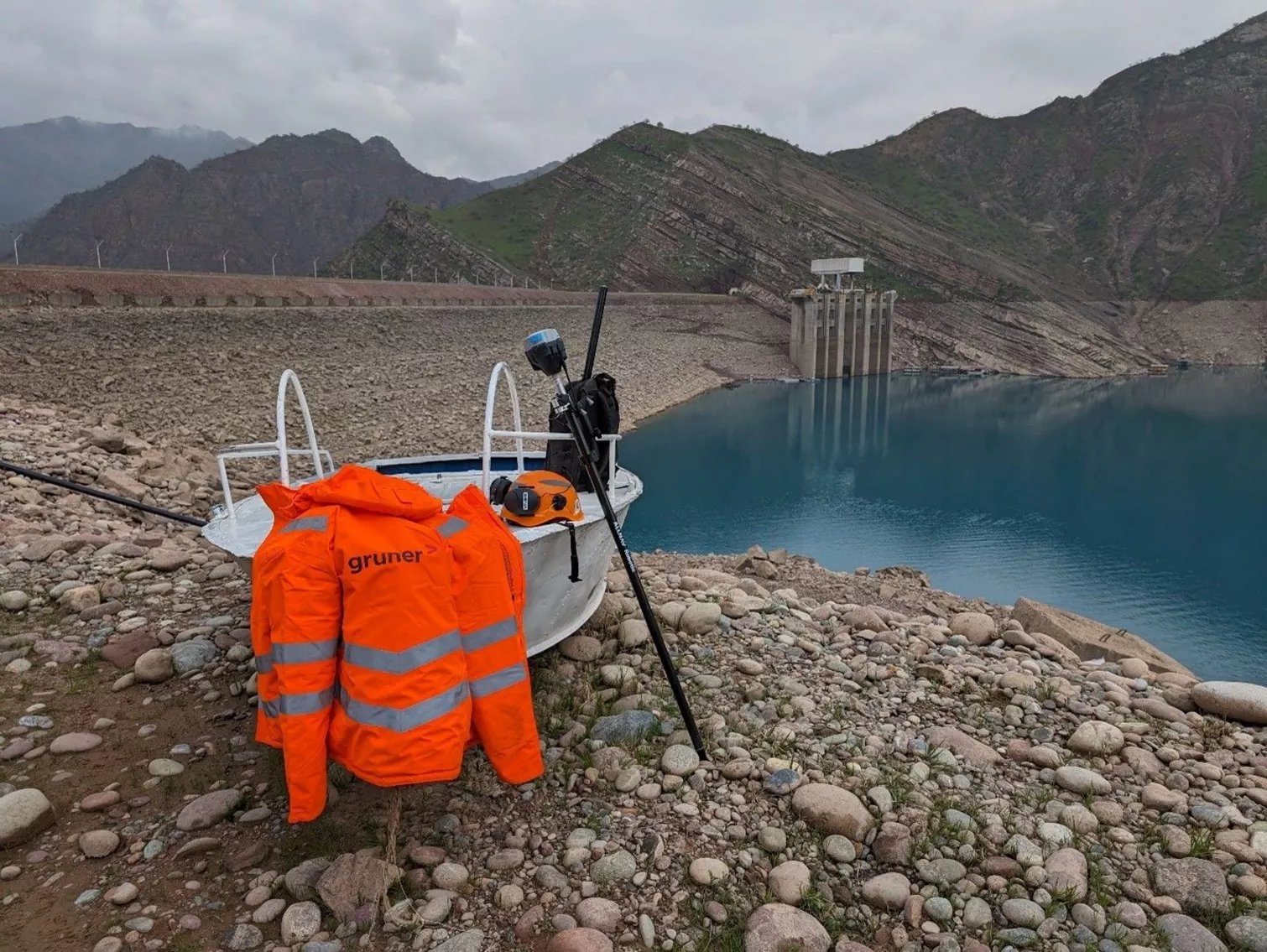
Gruner Stucky Ltd. has been the Owner's Engineer for the rehabilitation of the Nurek dam and hydropower scheme since 2017. The project is cofinanced by several international financial institutes led by the World Bank. As part of this contract, a cavitation assessment of the spillways had to be carried out to assess any damage done by cavitation. In order to do this study, a survey of the existing condition had to be carried out in order to generate an as-built model of the installations.
The Spillways
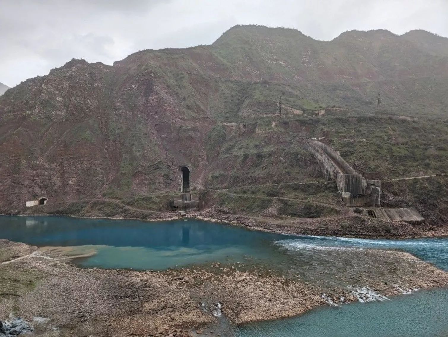
The reservoir has two spillways to regulate its water level: an Upper (Surface) Spillway and a Lower (Underwater) Spillway. During a recent project, the reservoir level was lowered by 60 meters, leaving the Upper Spillway gates completely out of the water. Despite this reduction, the Lower Spillway remained submerged, at a depth of around 40 to 60 meters. Under normal conditions, the Lower Spillway is about 90 meters below the water line. This adjustment was necessary to facilitate the rehabilitation of the Upper Spillway gates and the intake structure for the turbines.
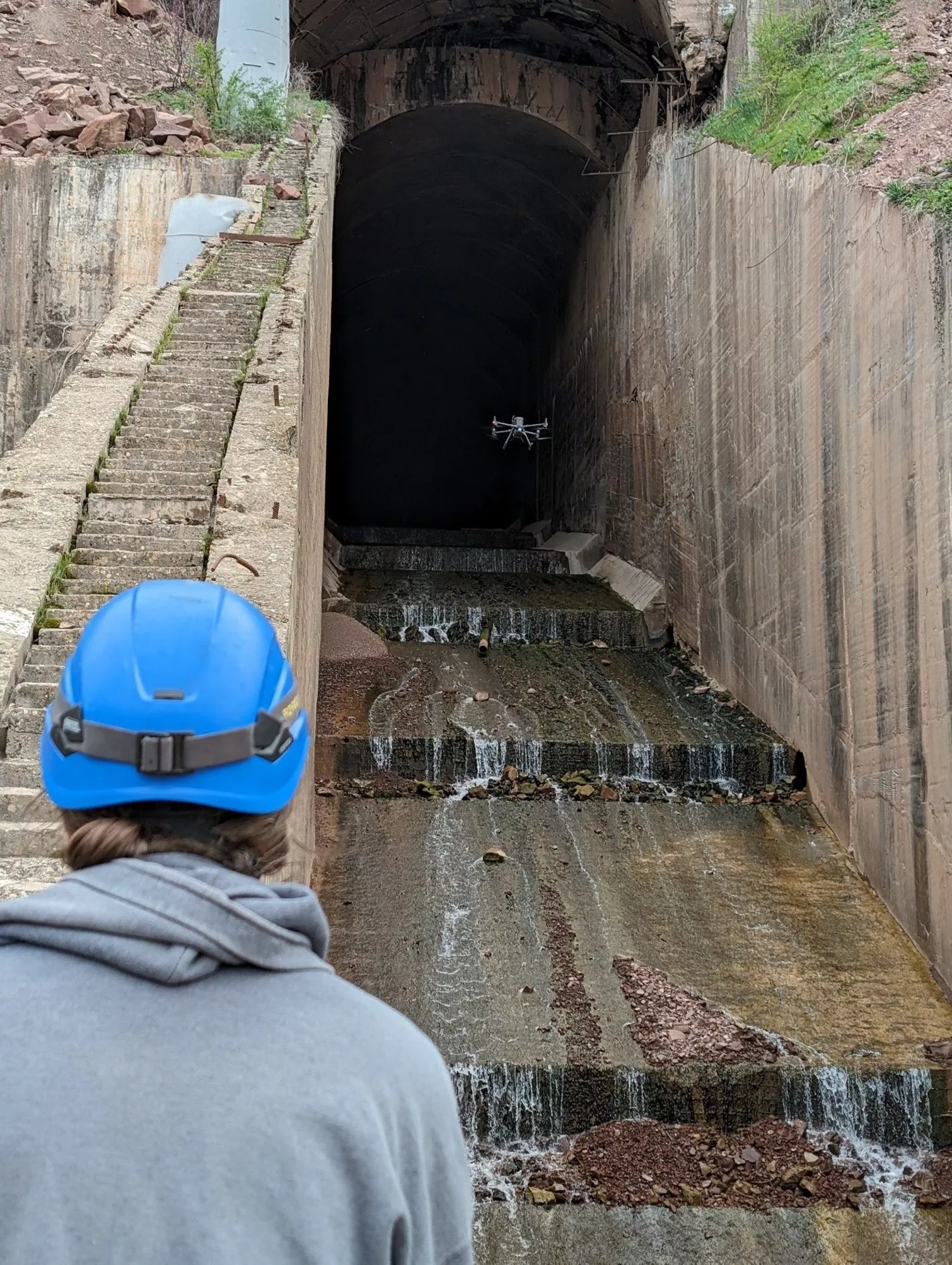
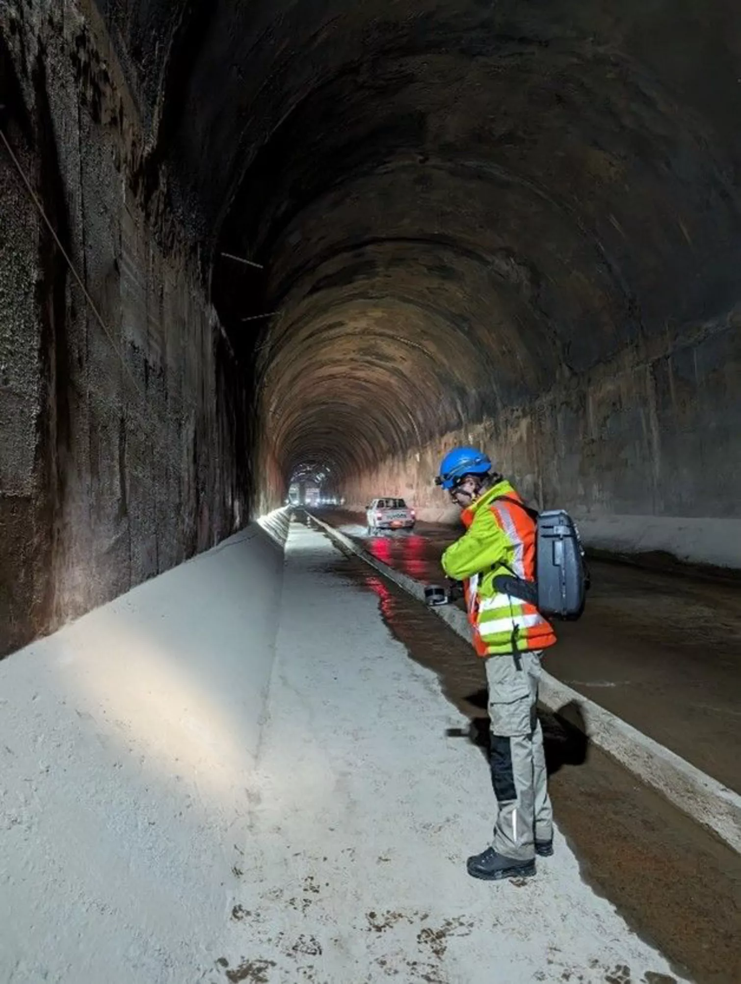
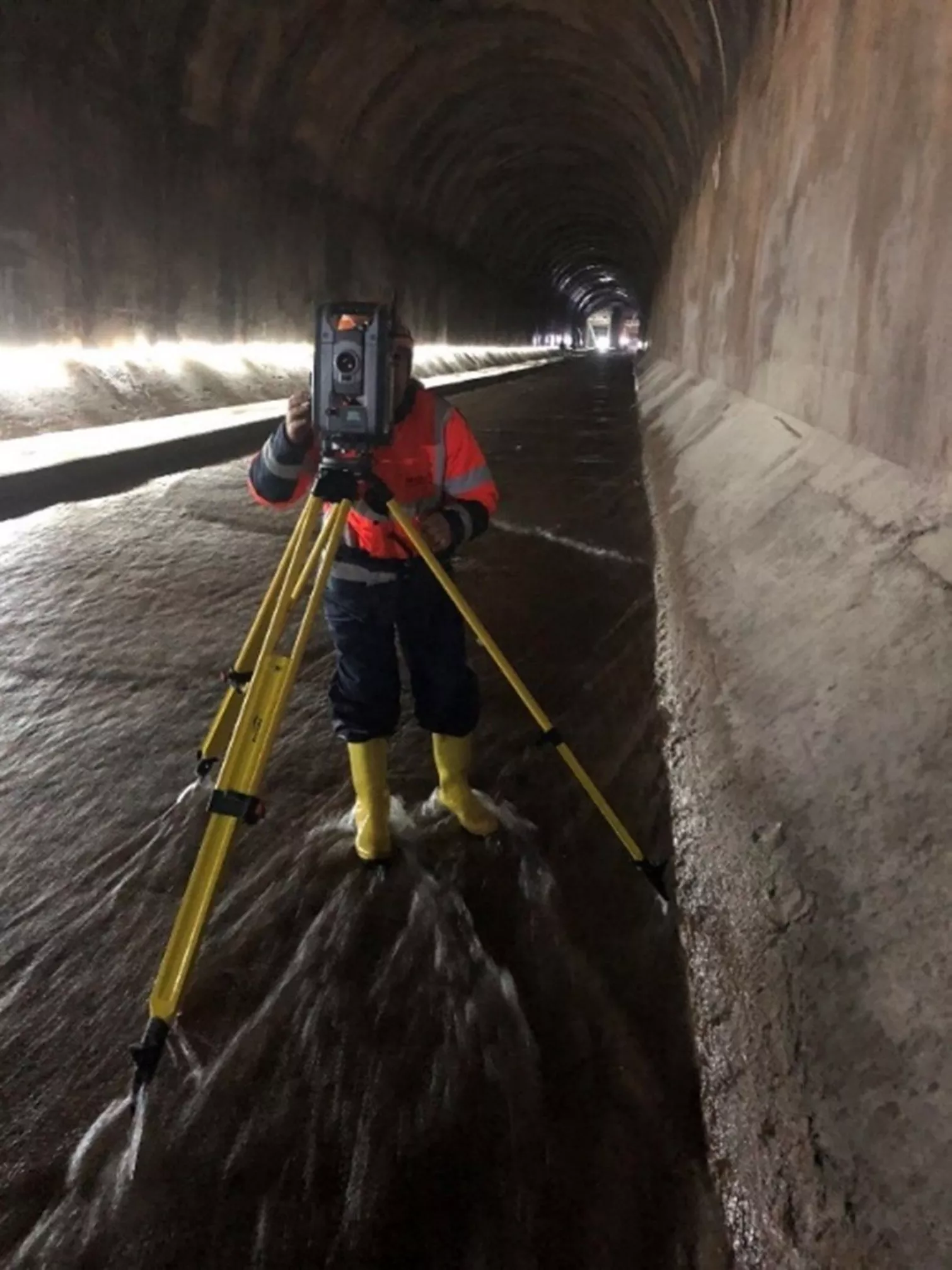
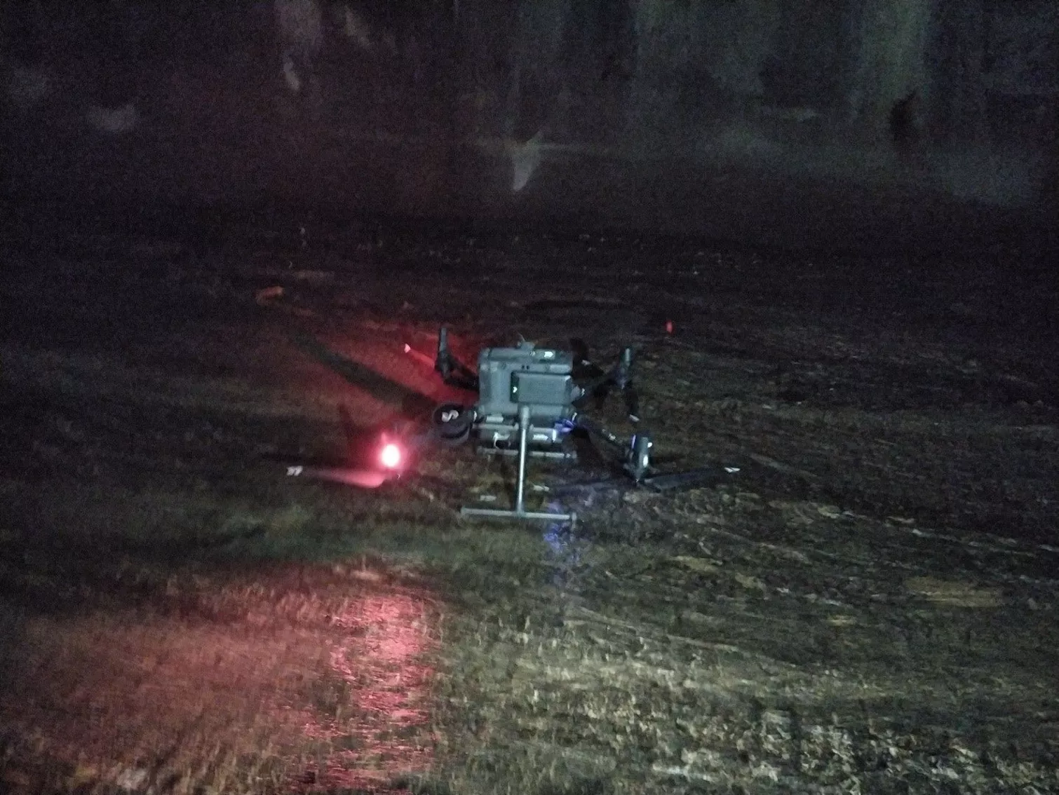
The Scan
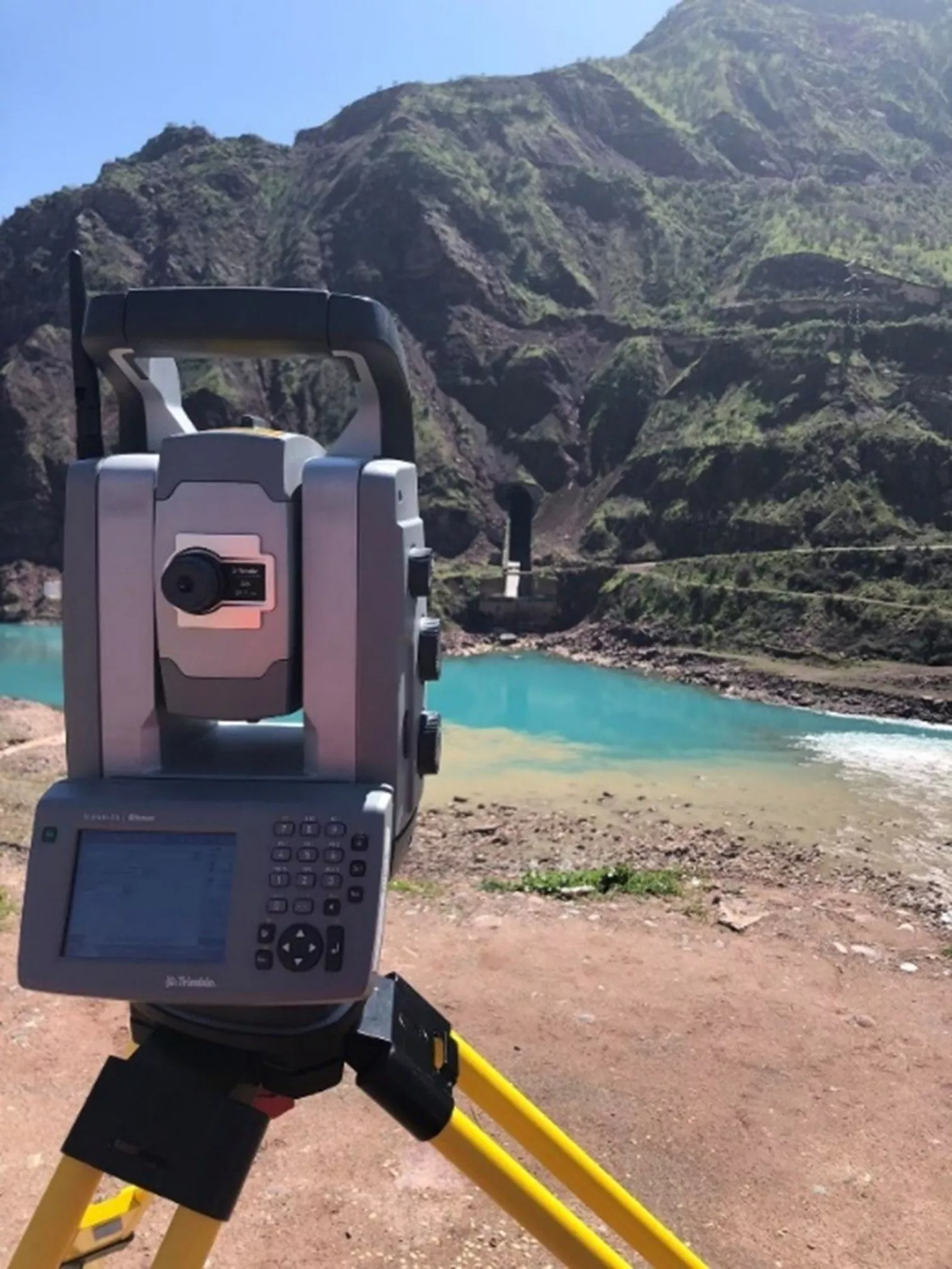
The task involved acquiring a LiDAR scan of both spillways. The Upper Spillway, approximately 1400 meters in length, and the accessible part of the Lower Spillway, around 1000 meters, were scanned. The horizontal sections of both spillways were scanned on foot using the Emesent Hovermap. The inclined part of the Upper Spillway, as well as the intake and exit structures, were scanned using a UAV with the Hovermap installed as a payload. Impressively, the UAV was flown inside the spillway tunnel for this purpose.
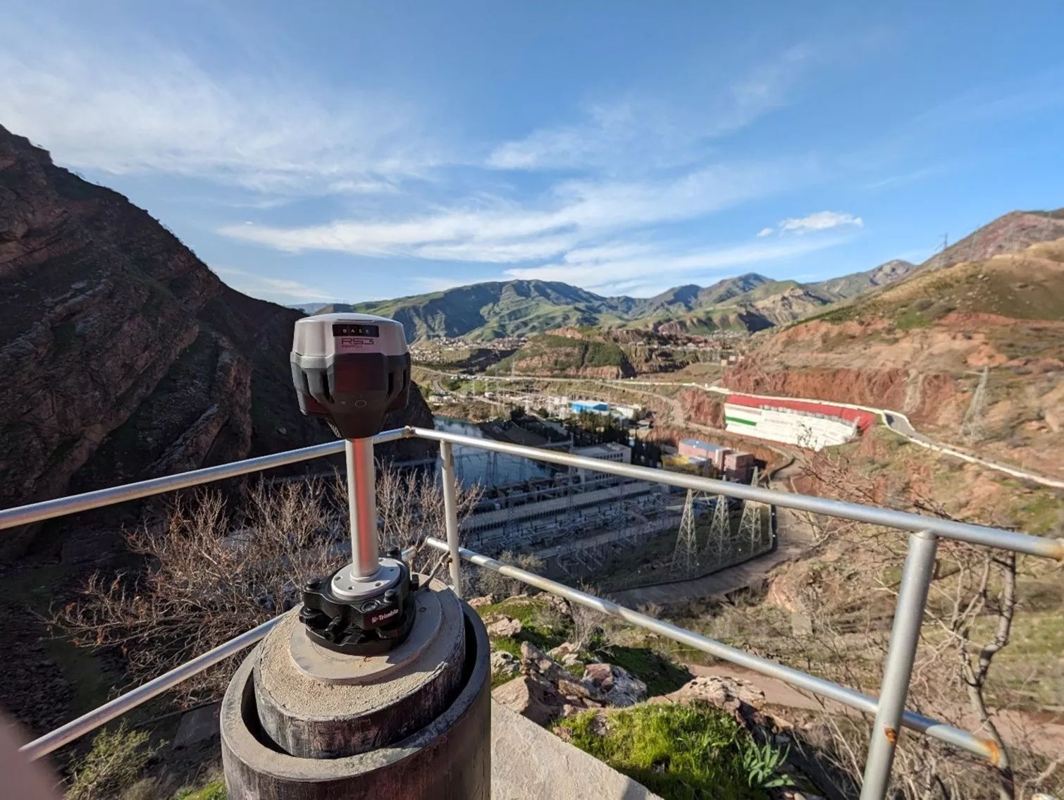
Additionally, we conducted four UAV flights with a ground sample distance (GSD) of 3 cm to capture the facilities around the hydroelectric power plant (HPP) and the intake and exit structures for both spillways. To ensure precise georeferencing of the scans and photogrammetric flights, a geodetic network was established. This network can also be used for future surveys.
Client
- OSHC Barki Tojik
Services
- 3D laser scanning services
- Topography and Cartography
Financing source
- IFIs led by World Bank